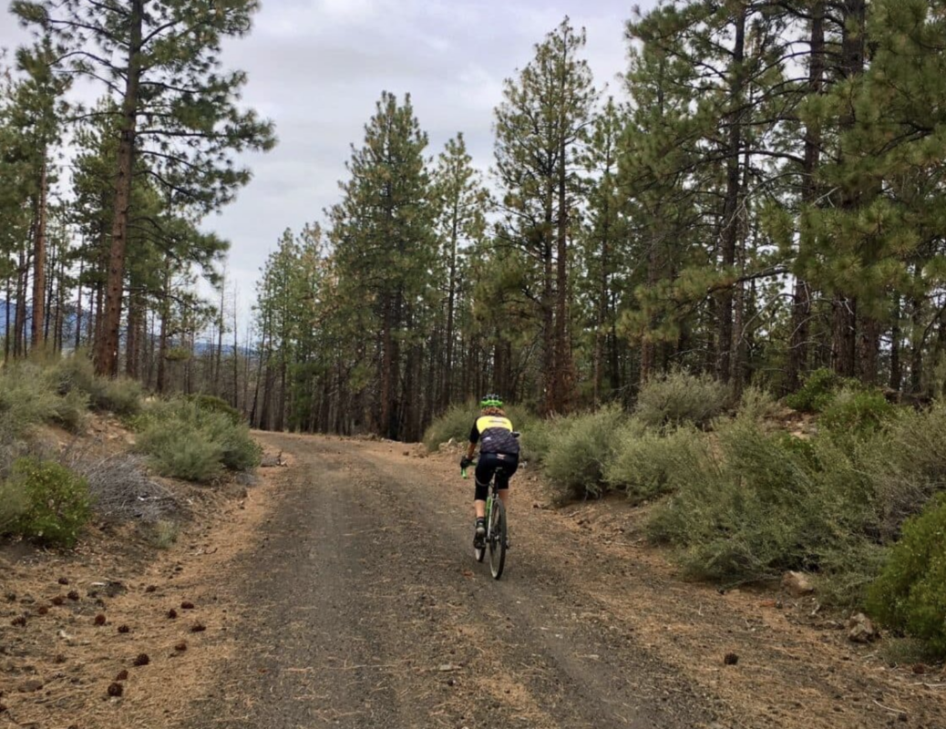
Twin Bridges (Gravel)
This is a gravel version of the classic Twin Bridges Scenic bikeway. It closely parallels the road version for the most part, but it deviates from the scenic bikeway for 8 gravel / dirt road sectors.
It is a close to town ride, without a lot of traffic, that offers up big views and ever-changing scenery with native, high-desert landscape, hobby farms, hay fields.
For many locals this is a go to late fall, winter and early spring ride. During the peak riding season there are many other great gravel rides in the Bend area that we would recommend that you pursue if time permits, they are a bit more remote and adventuresome.
Download Route (Ride with GPS)Big Red
Big Red sounds like the name of a dog … or an old pickup truck … or that kid in high school who played center on the basketball team. But in La Pine State Park, Big Red is the name of Oregon’s largest ponderosa pine tree. He’s an old guy … Over 500 years old, which means he was alive when Christopher Columbus was born … And he earns his name by topping off at 162 feet tall and 28.9 feet around.
Big Red isn’t the only reason to do this ride: There’s also a visit to the lovely Fall River Falls (yes, the name is really Fall River Falls.) And there are miles and miles of gently rolling single track trails along the Deschutes and Fall Rivers in La Pine State Park. Most of the ride is wonderfully shaded and the trails are mainly smooth and packed down.
There’s almost nobody on these trails; just mainly fly fishers who pride themselves on their secret fishing spots and hikers who are camping at the park. But you will see birds of prey: hawks, osprey, and even owls.
This ride is easy like Sunday morning. But it’s well worth the drive to La Pine just for all the river views … and the visit to Big Red.
Railbed Spurs
The initiating lollipop’s stick follows Forest Road 4606, the old Brooks-Scanlon rail line once connecting Bend to the Sisters engine house and reaching all the way to Black Butte. There is a short segment connecting 4606 to the logging spurs. This is also a conduit through private land where cycling is permitted and motorized recreation prohibited.
Westside Tour
The Westside Tour is just that …. A quick tour of Bend’s Westside. It’s a great entry-level ride that includes First Street rapids, the North River trail, Shevlin Park, Phil’s Trailhead, Good Dog Park, River Bend Park, Miller’s Landing Park, and Drake Park. Wow!
It’s a lot more urban than we normally ride, but we’ve tossed in enough forest roads to make it an honest gravel route.
What we love about his route is that it is chock-full of Bend history, culture, and heritage and has some amazing river and mountain views. There are kiosks for the first schoolhouse in Bend, the history of the irrigation dams, some old logging and mill implements, and a number of pieces of art and sculpture. So … get that bike out and ride and explore!